Your China & Yunnan Travel Experts


Reviewed: August 26, 2026
July is peak summer in much of China, but “hot everywhere” is not a workable forecast. Lowland cities can face humid heat, northern provinces enter a concentrated rain period, coastal routes may be altered by tropical cyclones, and plateaus can stay cool while receiving strong ultraviolet exposure and seasonal rain. If your trip starts earlier, compare the June weather guide; for every stop, use the current city forecast and official warning rather than a national monthly average.
Best planning approach: pair exposed outdoor sights with indoor or lower-risk alternatives, and consult the China climate guide before combining distant climate zones
1. North and Northeast China
Beijing, Tianjin, Hebei, Shanxi and parts of Inner Mongolia can be hot, but July is not reliably dry. North China's main summer-rain window often brings thunderstorms and intense short-duration rainfall. Check heat, lightning and flood warnings before exposed walls, gorges or long road transfers; move indoors when a warning is active.
2. East and Central China
Shanghai, Jiangsu, Zhejiang, Anhui, Hubei and Hunan often combine high humidity with heat. The meiyu transition is not a fixed date, and a clear morning does not rule out an afternoon thunderstorm. Typhoon rain can also affect places far from a landfall. Keep rail connections generous and do not continue onto closed mountain paths.
3. South China
Guangdong, Guangxi, Fujian and Hainan can experience oppressive humidity, intense sun, heavy rain and tropical-cyclone disruption. Guilin's karst scenery is green, but rain can reduce visibility or alter river and cycling plans. Never use air temperature alone to judge sea, river or gorge safety.
4. Western China
“Western China” contains deserts, basins, alpine valleys and the Tibetan Plateau. Turpan can be dangerously hot while high-elevation Qinghai or Tibet feels cool. Tibet also receives summer rain, so clear-sky marketing should not replace road, permit, landslide and altitude checks. Xinjiang distances require a forecast for the actual valley or lake—not only Urumqi.
5. Southwest China
Yunnan, Guizhou and Sichuan offer higher-elevation alternatives to lowland heat, but July is also a wet-season month. Mountain visibility changes quickly; prolonged rain can affect rural roads, trails and gorges. Keep weather-sensitive days movable and respect closures issued for landslide, rockfall or flood risk.
1. Inner Mongolia Grasslands
Region: North China
Weather decision: Days may be mild or warm, but strong sun, wind, thunderstorms and cool nights can occur on the same route.
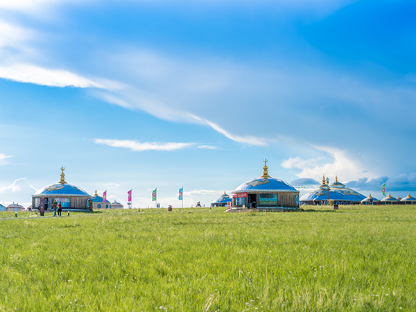
Why and how to go: Established Hulunbuir or Xilamuren stays can combine broad grassland scenery with local cultural programs. Nadam dates and locations vary; confirm the official program, ask before photographing people, use a responsible horse operator and keep vehicles on permitted tracks. The adjacent image shows a grassland setting, not a promised festival scene.
2. Lhasa and Central Tibet
Region: Tibetan Plateau
Weather decision: bright sun can alternate with summer rain; nights and higher passes are cooler.
Why and how to go: Use the first day for light activity, protect against ultraviolet exposure and follow medical advice for altitude symptoms. International visitors should verify current permit and organized-tour requirements before buying transport. Road access and monastery visiting arrangements remain subject to official notices.
3. Qinghai Lake
Region: Qinghai Province
Weather decision: cool to mild by day, colder after sunset, with strong sun, wind and passing rain.
Why and how to go: The high-altitude lake and seasonal flower landscapes can be striking, but bloom stages and cycling-event routes change by year. Use marked viewpoints, avoid disturbing nesting or grazing areas, allow acclimatization and carry insulation even when the lowland forecast is hot.
4. Zhangjiajie
Region: Hunan Province
Weather decision: warm, humid and rainy; mist can reduce or enhance views, while wet stone steps remain a safety concern.
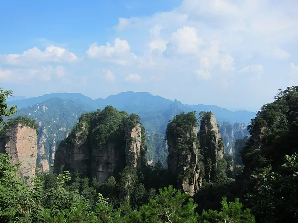
Why and how to go: The replacement photograph accurately shows Zhangjiajie's sandstone pillars. Start early, use official shuttles and trails, and keep a valley or indoor alternative for lightning, heavy rain or cableway closure. July crowds and heat make an unhurried two- or three-night base more realistic than a rushed day trip.
5. Jiuzhaigou Valley
Region: Sichuan Province
Weather decision: mild highland temperatures with seasonal rain and slippery boardwalks.
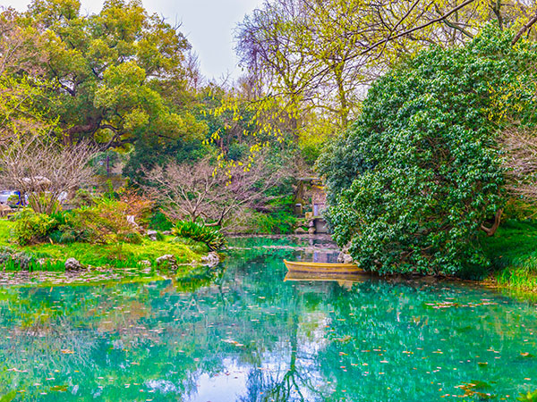
Why and how to go: Lakes and waterfalls are the focus, but color and visibility depend on light and weather. Reserve through the current official channel, remain on open boardwalks and avoid a tight same-day onward connection. The following lake image is location-specific, not evidence of conditions on your date.
6. Dali and Lijiang
Region: Yunnan Province
Weather decision: generally milder than China's hottest basins, with monsoon showers, strong ultraviolet exposure and cool mountain evenings.
Why and how to go: Build separate forecasts for Dali, Lijiang and any higher stop. Use established trails, respect Naxi, Bai and other communities as living cultures, ask before photographing residents and avoid entering working fields or courtyards without permission.
8 Days Chengdu, Jiuzhaigou and Mount Emei
Chengdu, Jiuzhaigou Valley, Leshan Giant Buddha and Mount Emei
Heat: Carry breathable clothing, a hat, sunscreen and water; follow local heat alerts, reduce exposed activity in the hottest hours and know where the next indoor stop is.
Rain and lightning: Pack a breathable rain shell, quick-drying layers, wet-surface footwear and document protection. An umbrella is not protection from lightning or severe wind.
Typhoons and floods: Check the National Meteorological Center and local transport or scenic-area channels daily on coastal and river routes. Keep flexible bookings and never enter a closed underpass, gorge, waterfront or mountain road.
Altitude: Plan a gentle arrival day, carry insulation and seek medical help for worsening symptoms. Continue with the August weather guide if your trip enters the next peak-summer period.
| Destination | Region | Typical July pattern | Why consider it | Planning constraint |
| Hulunbuir Grasslands | Inner Mongolia | Mild to warm days; cool, windy or stormy intervals | Green grassland scenery and locally announced summer events | Confirm event dates; use responsible riding and stay on permitted tracks |
| Lhasa | Tibet | Mild days, cool nights, strong ultraviolet exposure and summer showers | Monasteries, historic sites and plateau landscapes | Permit, acclimatization, road and weather checks are essential |
| Qinghai Lake | Qinghai Province | Cool high-altitude weather with wind, strong sun and passing rain | Lake scenery and seasonal flower landscapes | Cold evenings and altitude require layers and measured pacing |
| Zhangjiajie | Hunan Province | Warm, humid and rainy with changing visibility | Forested sandstone pillars and valley walks | Wet steps, crowds and weather closures need a backup plan |
| Jiuzhaigou Valley | Sichuan Province | Mild highland conditions with seasonal rain | Lakes, waterfalls and forest scenery | Timed entry, slippery boardwalks and long transfers |
| Dali | Yunnan Province | Mild to warm with monsoon showers | Erhai views, old-town heritage and slower pacing | Rain, ultraviolet exposure and lakefront controls vary daily |
| Lijiang | Yunnan Province | Mild days, cooler nights and showers | Old-town heritage and access to mountain landscapes | Separate city and mountain forecasts; reserve peak summer dates |
| Shangri-La | Yunnan Province | Cool highland days, cold nights and fast weather changes | Alpine landscapes and Tibetan cultural heritage | Altitude, road status and respectful community visits matter |
| Huangshan | Anhui Province | Cooler than lowlands but humid, foggy and rainy | Granite peaks, forest and cloud views | Views are never guaranteed; follow trail and cableway notices |
| Kanas Lake | Xinjiang | Mild alpine days, cool nights and variable rain | Lake, forest and mountain scenery | Long distances and changing access require advance route checks |
| Mount Emei | Sichuan Province | Cooler at elevation, with frequent rain and fog | Buddhist heritage and forested mountain paths | Slippery steps and macaque encounters require care |
| Chengdu and nearby highlands | Sichuan Province | Hot, humid city weather; cooler on higher routes | Panda bases, museums, food culture and onward mountain access | Do not assume pandas are active by month; check current visitor notices |
| Enshi | Hubei Province | Warm and humid with heavy-rain risk in mountain terrain | Karst gorges and forest scenery when routes are open | Attractions are dispersed; use current road and gorge-closure notices. |
| Ili Valley | Xinjiang | Warm valley days with cooler upland evenings | Grassland and late-season flower landscapes | Bloom is weather-dependent; use current local reports and legal access |
| Libo and Fanjing Mountain | Guizhou Province | Mild to warm, humid and rainy | Karst, waterfalls and mountain biodiversity | Summer crowds, wet trails and conservation rules require planning |
Editorial accountability
Hu Lei, CEO. The named owner is responsible for travel-planning accuracy and escalation of time-sensitive checks.
Yuntian Travel (Yunnan) Group is identified in its corporate profile as a licensed professional inbound travel service provider based in Kunming, China. Registration and travel-service documents can be requested before booking.
Page-specific references where cited, official destination, transport and entry notices, YUNSKY route-planning records, and direct provider confirmation before a booking is finalized.
Content is reviewed when rules, transport, access, pricing or route conditions change. Final availability and operating details are reconfirmed for each traveler’s dates.
Quality review: Page updated: